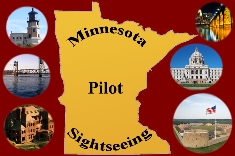
Minnnesota Sightseeing Charter
| Award Flight |
|
This flight requires our MN Sightseeing scenery from our downloads area.
Pilots are certainly welcome to fly this without the optional scenery download, but you will miss most of the waypoint scenic stops. You will be able to follow the rivers and roads, see a number of bridges that aren't the 'real' bridges included with the download. Only the MN State Capitol is visible with default fsx scenery (probably p3d also), but it's in the location as described below. You can also land at the airports described below - but without the download you won't see the bus waiting for you as described.
This flight takes about 3.4 hours in a Twin Otter, allowing a little time to find some of the sights. Anything faster than the Otter might make circling sights, finding them, and following roads difficult. Kodiak is a poor choice for this because of its tendency to fall out of the sky at low speeds. DHC2 might be good for finding the sights, but the long haul to Duluth and back in the Beaver might be too much for impatient pilots. It's also small for a group on a charter, but you can pick the best suitable aircraft in your hangar for this flight.
Pilot's Briefing
Use Flight Number 900834 for any PIREP filed for this flight - even if you do it in multiple legs.
Note: You will want to look at the Passenger Itinerary to familiarize yourself with the various sights to help you recognize them from the air. Also, in addition to the flight chart segments included, it might help to pause your sim and go to top-down view. You can use the '+' or '-' keys to zoom in and out. This will give you a better overall view of the road and river layouts you will be following, as many GPS's don't depict roads. I'm not giving a flight plan on this, so you're on your own. Of course, you can Google these sites and punch those into your GPS if you wish, or you can try to follow the visual cues described below to find your destinations. There's also a PDF version of the Pilot's Briefing included with the scenery zip file downloads. You may also wish to use your own charts like those from Airnav.com and maybe even some online street maps to zoom in to various areas.
In addition to the scenic waypoints described below, the flight plan is KMSP-KSTP-KDLH-KSTP-KMSP. The reason and order for these stops are described in the Pilot's Briefing below. The Duluth stop offers a good stopping point for pilots wishing to split the flight into two separate flights.
After picking up your plane and fueling up at KMSP you can pick up your passengers for the morning-afternoon Minnesota sightseeing tour.
Your passengers have enjoyed a welcome breakfast at Holman's Table Restaurant at Holman's Field (KSTP), and have now been bused to their pickup point just off Rwy 13. Look for the bus there.
Your first flyover is Historic Fort Snelling. Follow Mississippi River westward where it turns south so you're flying towards KMSP. The historic fort on your left as you follow the river and is marked by a red star on the map, and is at the headwaters where Minnesota and Mississippi Rivers meet. Fly your guests around the fort for pictures, but be careful to stay near the fort and not stray over KMSP. You've been given special clearance for this flyover, but are advised to avoid overflying the runways at KMSP.
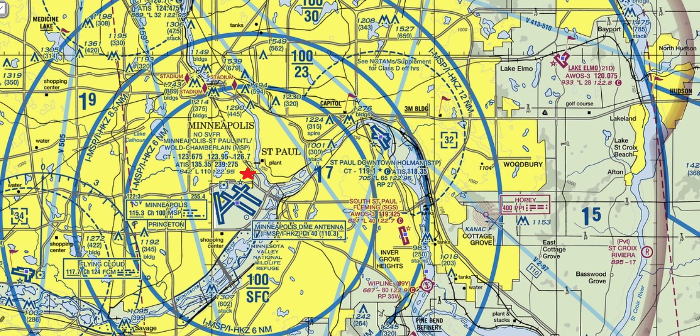
The next stop is Minnehaha Falls. Continue following the Mississippi River north. On your left you'll see two lakes, a larger and a smaller one. The larger is Lake Nokomis and the smaller Lake Hiawatha. The larger road just east of the lakes is Hwy55 or Hiawatha Avenue. Minnehaha Creek runs eastward from Lake Hiawatha to the Mississippi River and Minnehaha Falls is along the creek just west of the river and between Hwy55 and the river as depicted by the red dot on the map. Circle the falls so your guests can get pictures.
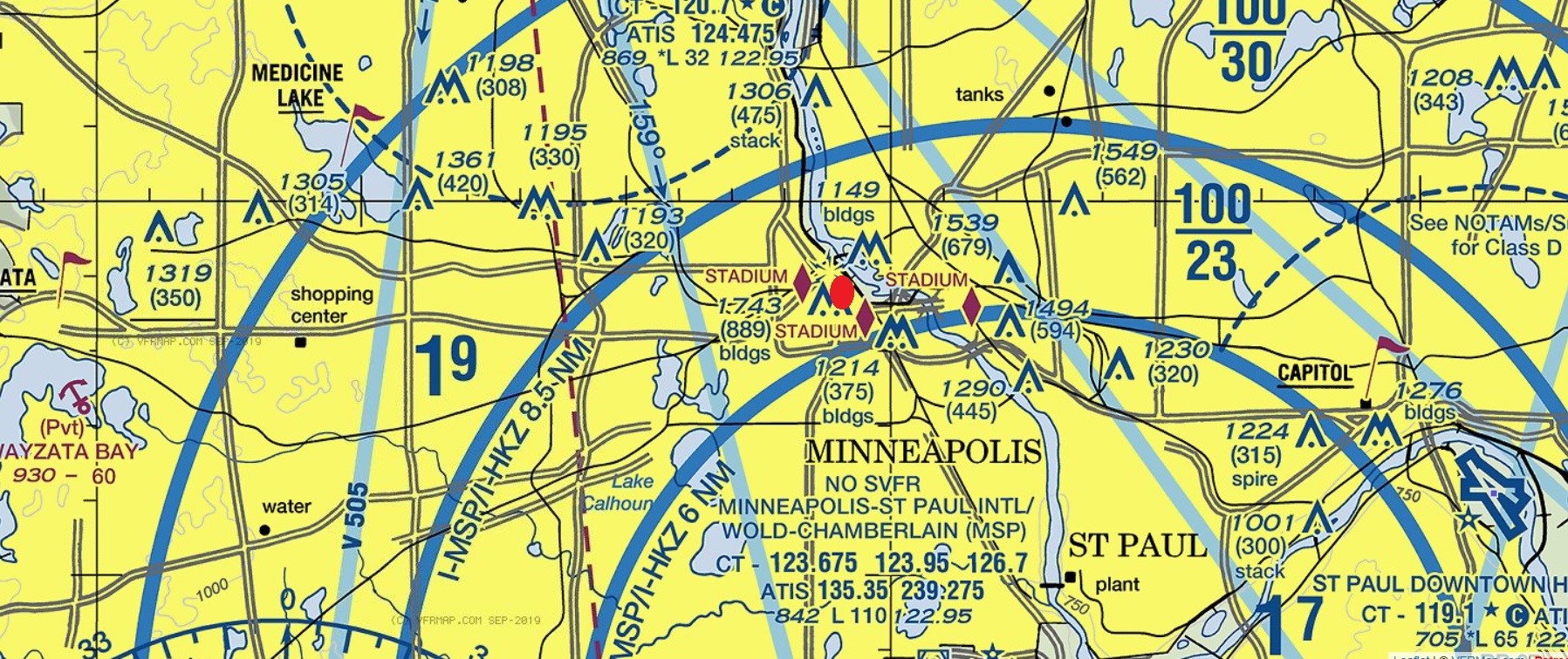
The next stop is farther north up the river. You'll go over a few more bridges, but watch ahead for some outcroppings of land on the east side of the river followed by a large island (Nicollet Island). Be low and slow well-ahead of the island because, south of, and before the island is the Stone Arch Bridge. Circle the bridge to allow your guests to take pictures before circling back south along the river
The next stop is west, farther into Minneapolis. Continue southeast along the river to the last bridge before the stone arch bridge. That's the I35W bridge - yep, the one that fell into the river a few years back killing some folks. You can point out the beautiful new bridge and tell them about that recent tragedy. Follow I35W southwest until it intersects with I94 running east/west. Follow that westward past Interstate 35W that runs north/south. A bit past 35W I94 turns sharply north. Go low and slow as your follow I94 north and the Basilica is on your right just past Loring Park which is the park with the two little ponds on your right.
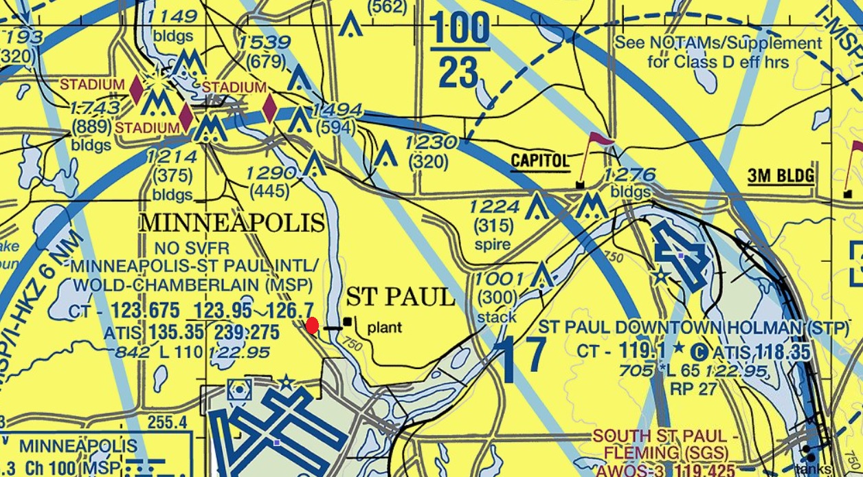
Now back east into downtown Saint Paul where we pick up 3 stops all within sight of each other. Follow the highways back the way you came, south on I94 and its sharp turn to the east. I94 will take us right into downtown Saint Paul. Follow it east and then southeast and east again to downtown St. Paul. As you approach the busy downtown area, you'll see a larger secondary road crossing I94 north/south. That's Kellogg Blvd. and if you look to your right you should see the dark JJ Hill House off to your right between I94 and I35E that intersect just farther east on 94. If you cross the intersection of I94 and I35E you went too far.
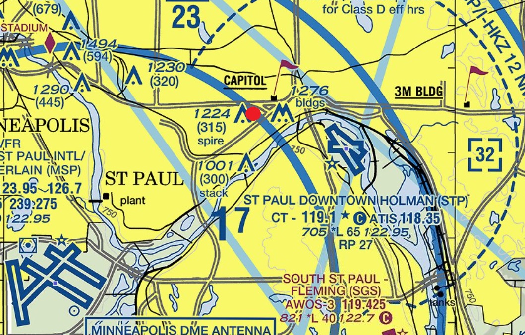
Almost due east of JJ Hill is the Landmark Center just across I35E, and the Minnesota State Capitol is north between Hill and Landmark, just north of the intersection of I94 and I35E. Wow...now that your passengers are catching their breath from that volley of photo-taking, you will fly northwest to Stillwater for our next sightseeing destination - the Stillwater Lift Bridge.
Continue east along I94 - don't veer north along 35E - I94 is the split freeway running due east. Continue until you hit the next large river about the same size as the Mississippi - just a little past Lake Elmo Airport(21D). That's the St. Croix River. Turn north and follow the river north into Stillwater where you'll find the historic Stillwater Lift Bridge. Circle for pictures before we head up north out of the twin cities metro area. You can refer to the first map in the briefing that shows Lake Elmo Airport at the far right and the St. Croix River. That's I94 that runs just south of the airport, and you'll easily see the St. Croix River as you approach.
Now it's almost time for lunch - and those passengers will want to stretch their legs before finishing the trip. Lunch is being held at the Duluth Radisson at the revolving restaurant at the top where guests can continue sightseeing with their lunch. Set your course for KDLH and fly there. Just east of the airport along the shore of Lake Superior is the historic Duluth Aerial Lift Bridge that allows the large lakers to cross into safe harbor. Circle that for picture before landing at KDLH. The bus is waiting at Duluth Airport (KDLH) in General Aviation area behind the tower to take your guests to lunch. As you approach KDLH from the east, you'll see a small airport along the shore of Lake Superior a bit east of KDLH. That's Sky Harbor Airport (KDYT) located on Park Point. Fly west along Park Point - on either side, and you'll run into the aerial bridge on the west end of Park Point.
You can grab a quick bite while you refuel for the last short sightseeing hop to Split Rock Lighthouse before bringing everyone safely back to your starting area at KSTP (Holman Field) where your guests' bus will be waiting.
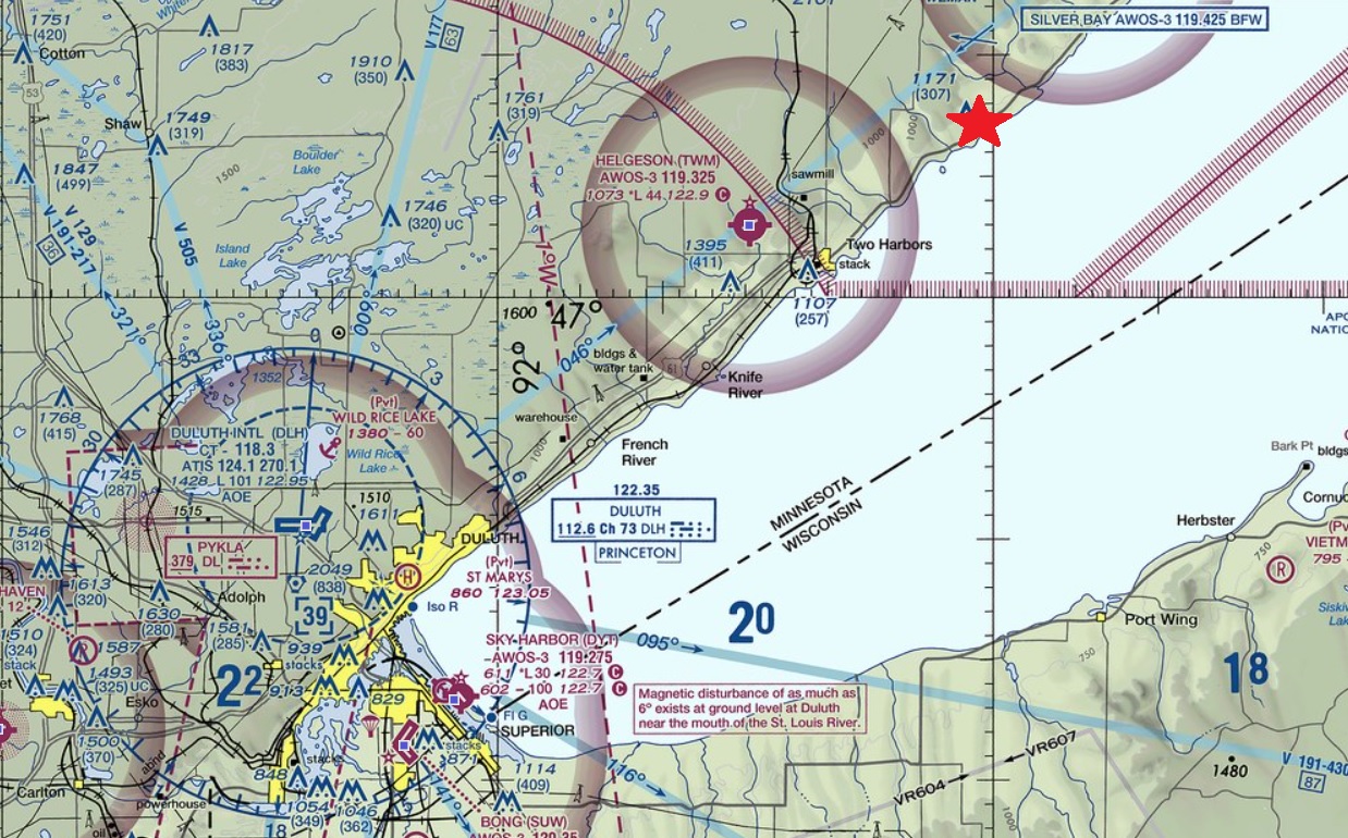
Now...finally, on to Split Rock. Follow the western shore of Lake Superior north up past Two Harbors to Split Rock Lighthouse. Circle for pictures.
Fly your passengers back to Holman Field (KSTP) to their waiting bus.
Fly back to KMSP to secure your plane in its hangar.
Passenger Itinerary
A Welcome Breakfast at Holman's Table Restaurant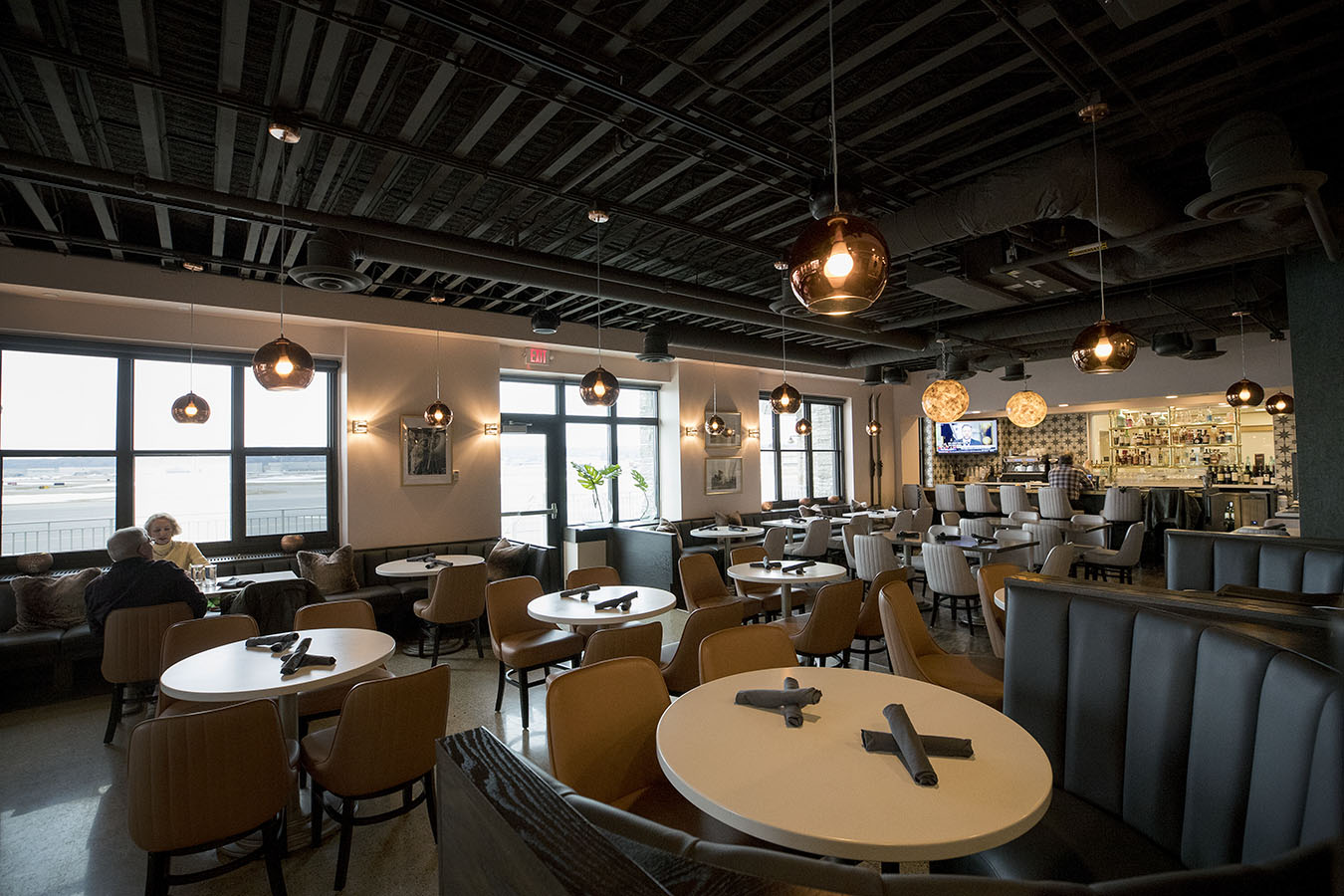 |
Historic Fort Snelling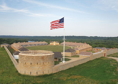
|
Minnehaha Falls
|
Stone Arch Bridge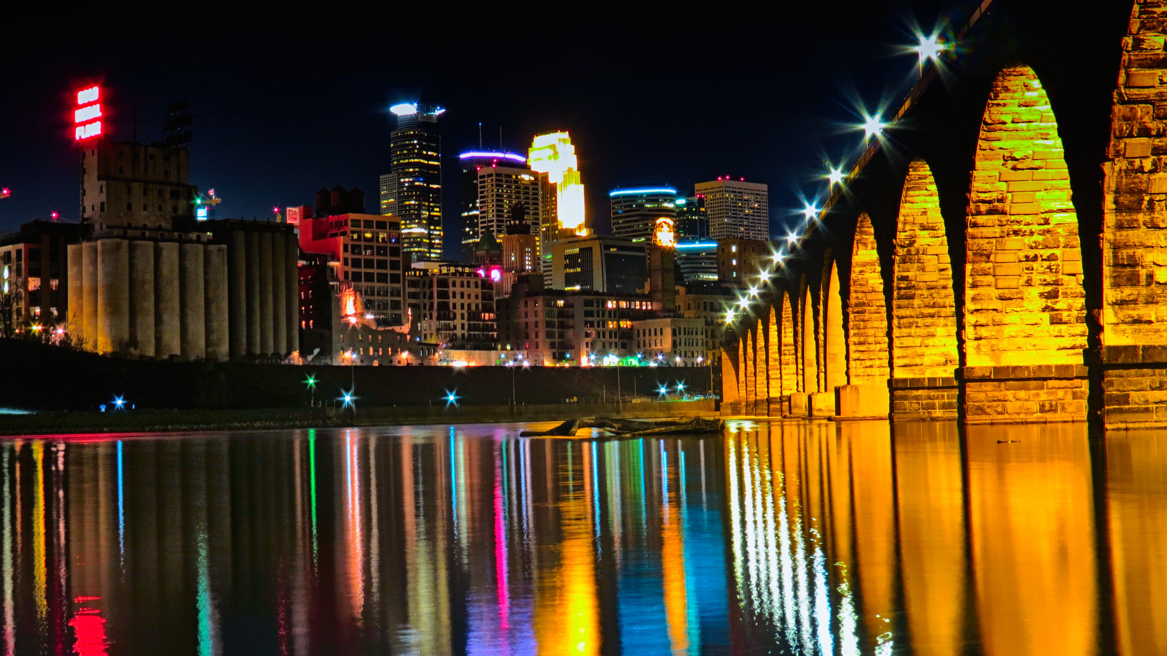
|
Basilica of Saint Mary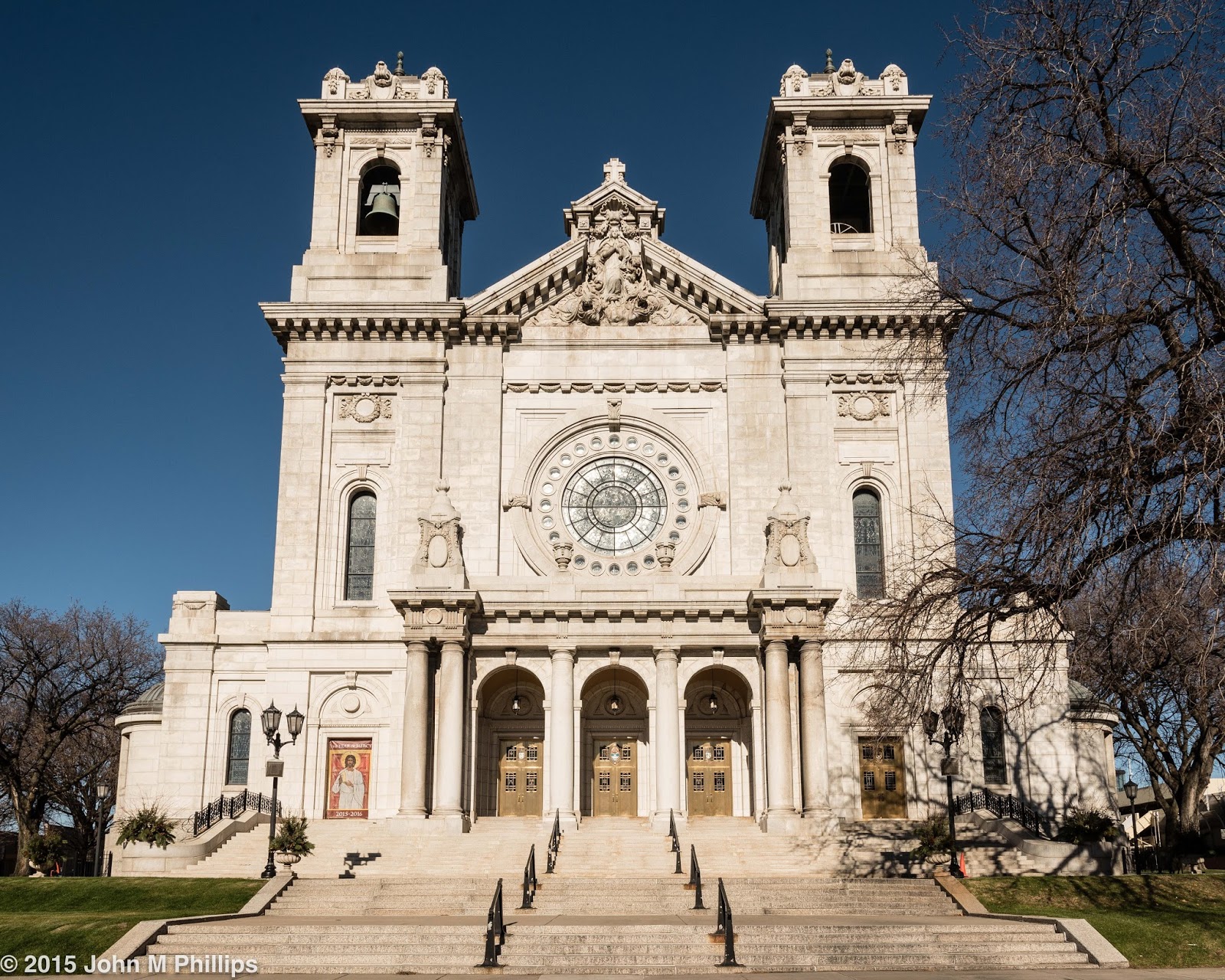
|
James J. Hill House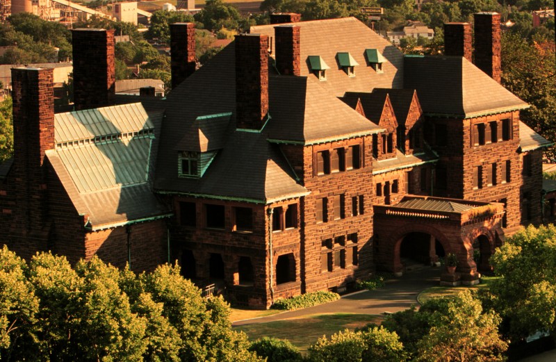
|
Landmark Center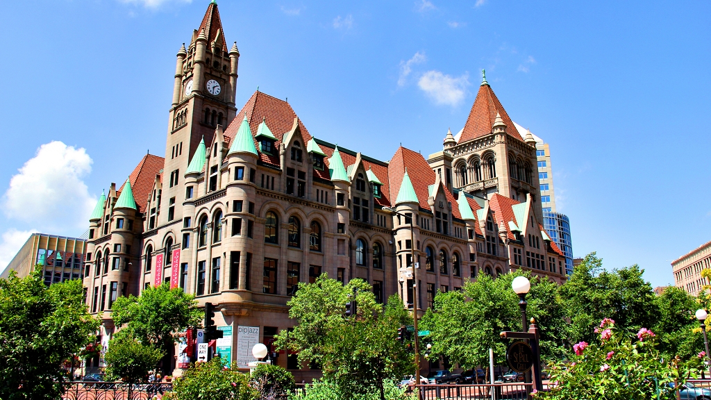
|
Minnesota State Capitol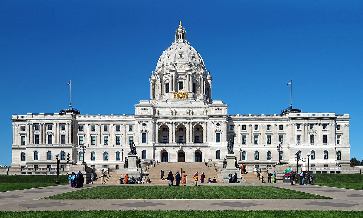
|
Stillwater Lift Bridge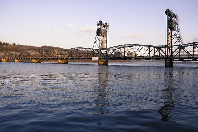
|
Duluth Aerial Lift Bridge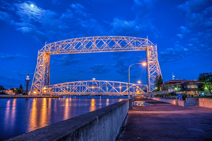
|
Lunch at Duluth Harborview Radisson Restaurant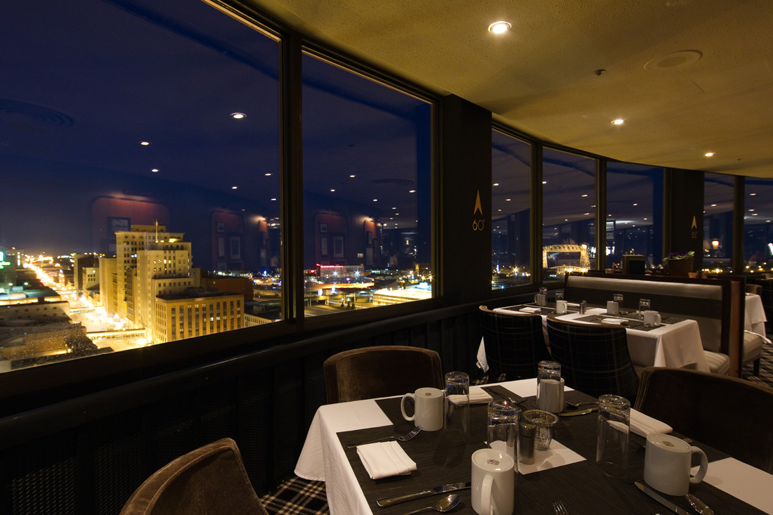
|
Split Rock Lighthouse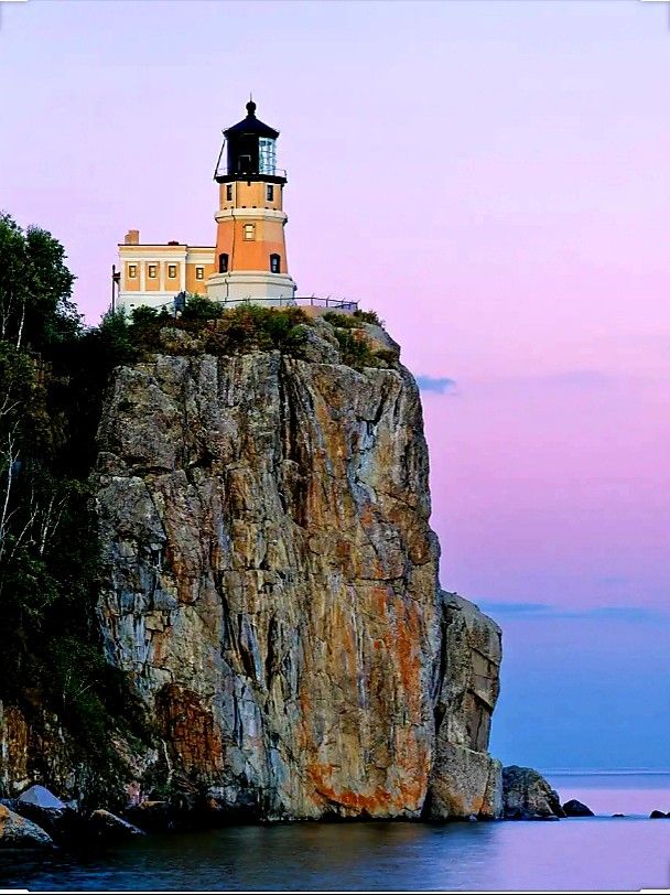
|
Return to Holman's Field - Holman's Table Restaurant |
|